STAR calculates the estimated time to complete a sampler’s field round and estimates if the work can be completed. TAPS holds the geographic position of each site in the database, the expected access time to enter a site, the route around the site for a specific sampler and the expected sampling time at each location.
Information on the sampler or field staff is also held. This includes the start of day and end of day grid reference for the sampler, an average travelling speed and the working hours (including lunch breaks). Working hours can be overridden at the time of creating a schedule and the printing of round sheets to reflect current availability.
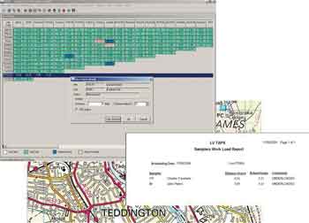
From this information, STAR calculates the expected time to complete a field round and checks if the sampler is over or under loaded.
Benefits
Having calculated the workload for the field staff you can ensure sensible rounds can be assigned and that the work requested can be completed with the available resources. Alternatively, STAR will give you the ability to assign work more evenly between samplers.
Daily Work Hours Adjustments
Working hours and geographic position of the samplers can be overridden for a particular day’s schedule if the sampler was not available for the full working day.
Basic Straight-Line Calculation
The most basic option uses straight-line distance, access time, sampling time and an average speed to calculate workload. Compared with a manual process this is a large improvement and often identifies resource optimisation.
Option for Matrix Adjustment
Straight-line distance and average travelling speeds are only indicative. This becomes even more inaccurate if roads are difficult to travel or you have two sites close by either side of a river with the bridge some distance away. Site Matrix allows you to define special travelling conditions between two sites to calculate a more accurate estimate of workload.
The round can be exported to a digital file that can be loaded into ESRI or MapInfo. This will allow for the creation and printing of route maps, optimised routing and accurate estimate of distance, time and workload.